Aqua Map Montana - Lakes GPS Offline Nautical Charts 6.1
Paid Version
Publisher Description
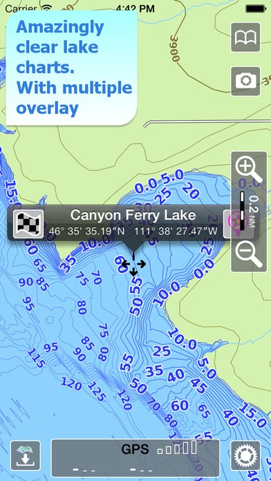
An app to satisfy all your Fishing and Boating's needs, developed with the help of professional fishermen. CHECK YOUR LAKE HERE BEFORE YOU BUY!: http://www.globalaquamaps.com/MTviewer.html You will be able to download the best maps and enjoy your new fishing season. Press the RECORD button, put the phone in your pocket and record your fishing trolling track....and much more. Features: Amazingly clear maps, thanks to the Retina technology usage. User friendly iOS 7 interface. Optimized battery usage with battery consumption monitoring; up to 14 hours continuous track. You can download maps (for FREE, no additional purchase is required) on the device, to be used later without any internet connection. 694 Montana lakes available, plus a complete topographic map to reach the most remote lakes and rivers. Store your track without the need of cellular data or phone signal. No problem to receive/make phone calls and messages while recording the tracks. Share tracks, markers and pictures in various formats (KMZ and GPX). Store an unlimited number of tracks and markers. Customize your Marker's icon and Track's color. Switch between Map display modes (Offline, Satellite, Roads). Measure distances on the map. Load any track and marker from internet communities (KMZ, KML, GPX also if zipped) Query map objects with your finger tip Search map objects around you, around a point, search places by name worldwide Plan and navigate your ROUTE ActiveCaptain community integration MAPS Aqua Map lets you download the best maps with depth contours, boat ramps, etc. but also a complete Topographic map with road network, trails, elevation contours, lakes, rivers, etc. and all it is necessary to enjoy your best outdoor experience, for FREE!! No additional purchase is required. You can download the maps at home within your device and then use them on the boat without any Internet connection need. SHARING Why do not sharing your favorite's markers on Facebook or sending an email with your last daily track, with all the pictures you captured to show them on Earth or Maps ? With Aqua Map it is just a click. LOADING OTHER's TRACKS AND MARKERS Aqua Map can load any KML, KMZ, GPX (also zipped) you can find over the internet or received from your friends. You can load tracks and markers generated from any application (e.g. Google EarthTM, Maps, or other iPhone/iPad apps), obviously including Aqua Map, or any device (e.g. Garmin Etrex, Nuvi, Magellan, etc.). SEARCH OBJECTS AND LOCATIONS By name, worldwide and around you ROUTES and WAYPOINTS Plan your trip, insert and edit waypoints. Navigate your route and monitor distance, time and direction toward your next waypoint. ENJOY ActiveCaptain Community Join the community of more than 100.000 boaters who write reviews, update data and provide up to date hazard information on ActiveCaptain View and contribute to the best marinas location database in the world Read and contribute reviews and rating about marinas, shared local boating knowledge, anchorage and hazards OPTIMIZED BATTERY USAGE Unlike many other apps, Aqua Map is designed to use at the best the battery power to ensure being usable for at least one full day. Its Battery Consumption Monitoring will stop the track recording when the battery is too low, in order to ensure the phone is still usable at the end of your outdoor's day. iOS BACKGROUND MODE Aqua Map works also when in background, you can receive/make calls and messages while the track recording is running. Like any GPS, the signal quality can vary very much depending by the amount of visible sky, foliage, weather condition, etc. GPS is not reliable indoor. The continuous GPS usage, also in background, can drastically reduce the battery life. For more information please visit our website at: www.globalaquamaps.com or send us an email at: info@globalaquamaps.com
Requires iOS 8.2 or later. Compatible with iPhone, iPad, and iPod touch.
About Aqua Map Montana - Lakes GPS Offline Nautical Charts
Aqua Map Montana - Lakes GPS Offline Nautical Charts is a paid app for iOS published in the Recreation list of apps, part of Home & Hobby.
The company that develops Aqua Map Montana - Lakes GPS Offline Nautical Charts is GEC s.r.l.. The latest version released by its developer is 6.1.
To install Aqua Map Montana - Lakes GPS Offline Nautical Charts on your iOS device, just click the green Continue To App button above to start the installation process. The app is listed on our website since 2014-03-02 and was downloaded 1 times. We have already checked if the download link is safe, however for your own protection we recommend that you scan the downloaded app with your antivirus. Your antivirus may detect the Aqua Map Montana - Lakes GPS Offline Nautical Charts as malware if the download link is broken.
How to install Aqua Map Montana - Lakes GPS Offline Nautical Charts on your iOS device:
- Click on the Continue To App button on our website. This will redirect you to the App Store.
- Once the Aqua Map Montana - Lakes GPS Offline Nautical Charts is shown in the iTunes listing of your iOS device, you can start its download and installation. Tap on the GET button to the right of the app to start downloading it.
- If you are not logged-in the iOS appstore app, you'll be prompted for your your Apple ID and/or password.
- After Aqua Map Montana - Lakes GPS Offline Nautical Charts is downloaded, you'll see an INSTALL button to the right. Tap on it to start the actual installation of the iOS app.
- Once installation is finished you can tap on the OPEN button to start it. Its icon will also be added to your device home screen.
